10 Mar 2020
LiDAR Lateral Localisation Despite Challenging Occlusion from Traffic
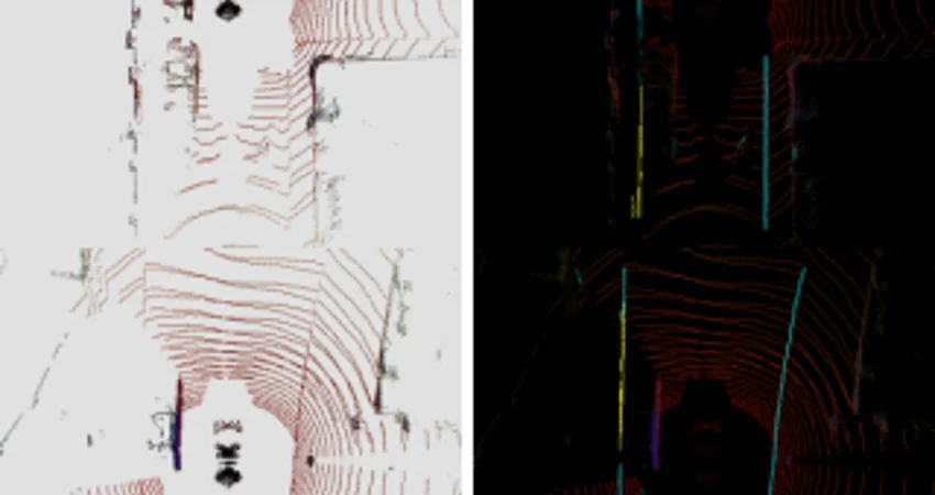
This paper presents a system for improving the robustness of LiDAR lateral localisation systems. This is made possible by including detections of road boundaries which are invisible to the sensor (due to occlusion, e.g. traffic) but can be located by our Occluded Road Boundary Inference Deep Neural Network. We show an example application in which fusion of a camera stream is used to initialise the lateral localisation. We demonstrate over four driven forays through central Oxford – totalling 40 km of driving – a gain in performance that inferring of occluded road boundaries brings.
Further Info – For more information please read our paper:
![[PDF]](https://ori.ox.ac.uk/wp-content/plugins/papercite/img/pdf.png) T. Suleymanov, M. Gadd, L. Kunze, and P. Newman, “LiDAR Lateral Localisation Despite Challenging Occlusion from Traffic,” in IEEE/ION Position, Location and Navigation Symposium (PLANS), Portland, OR, USA, 2020.
T. Suleymanov, M. Gadd, L. Kunze, and P. Newman, “LiDAR Lateral Localisation Despite Challenging Occlusion from Traffic,” in IEEE/ION Position, Location and Navigation Symposium (PLANS), Portland, OR, USA, 2020.